Hiking the Incheon Jongju-gil
The Incheon Jongju-gil (인천 종주길) is a hiking trail in Incheon, South Korea. The name translates simply as “long distance trail”, but I have seen the English names “Ridge Trail” or “Green Ridge Trail” on signposts. It runs 64km in a loose S-shape from north to south, following a series of small mountains and green spaces. The highest peak is less than 400m and the mountains are right next to dense city, usually near a subway station, so this is a very accessible trail.
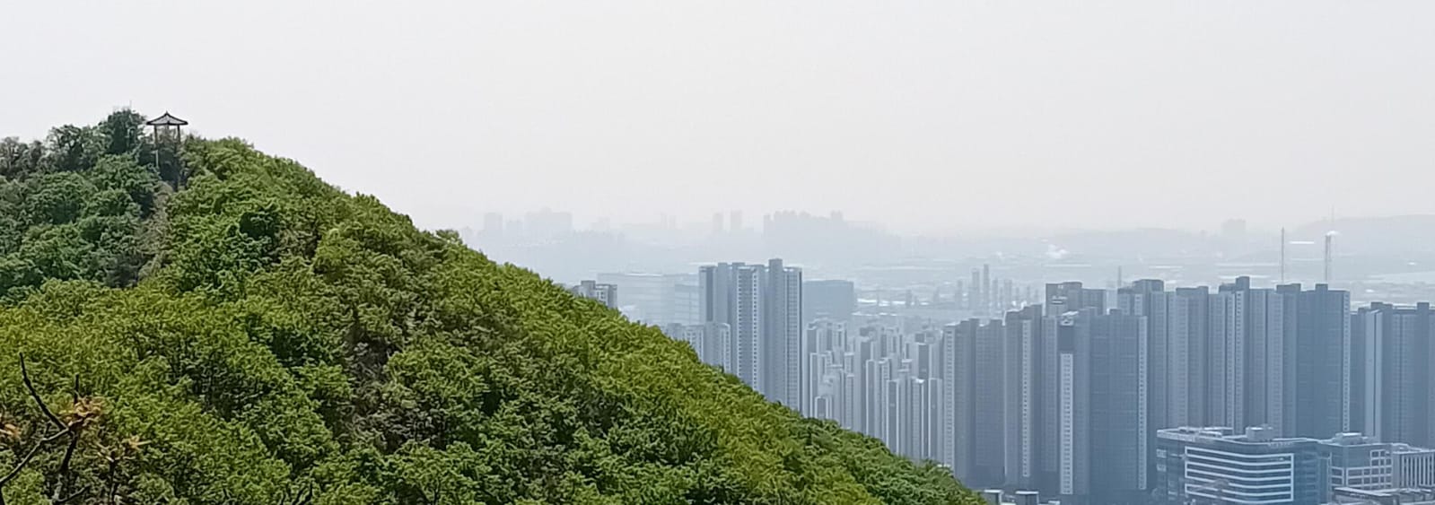
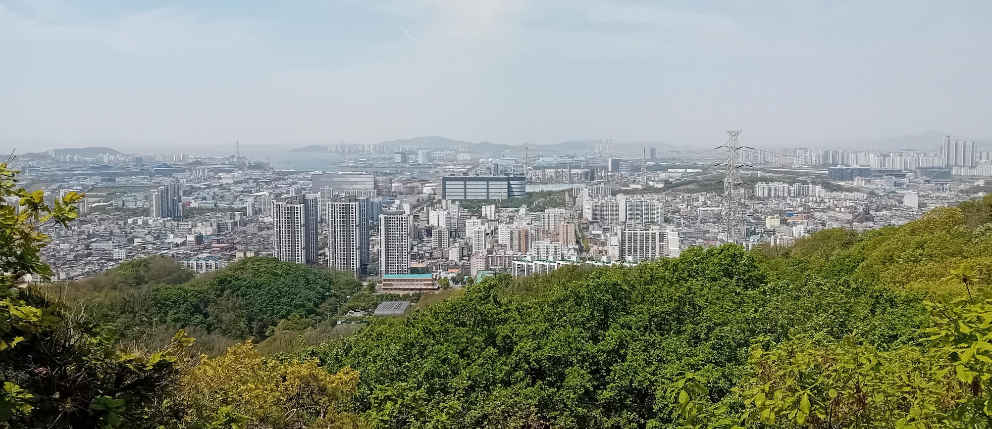
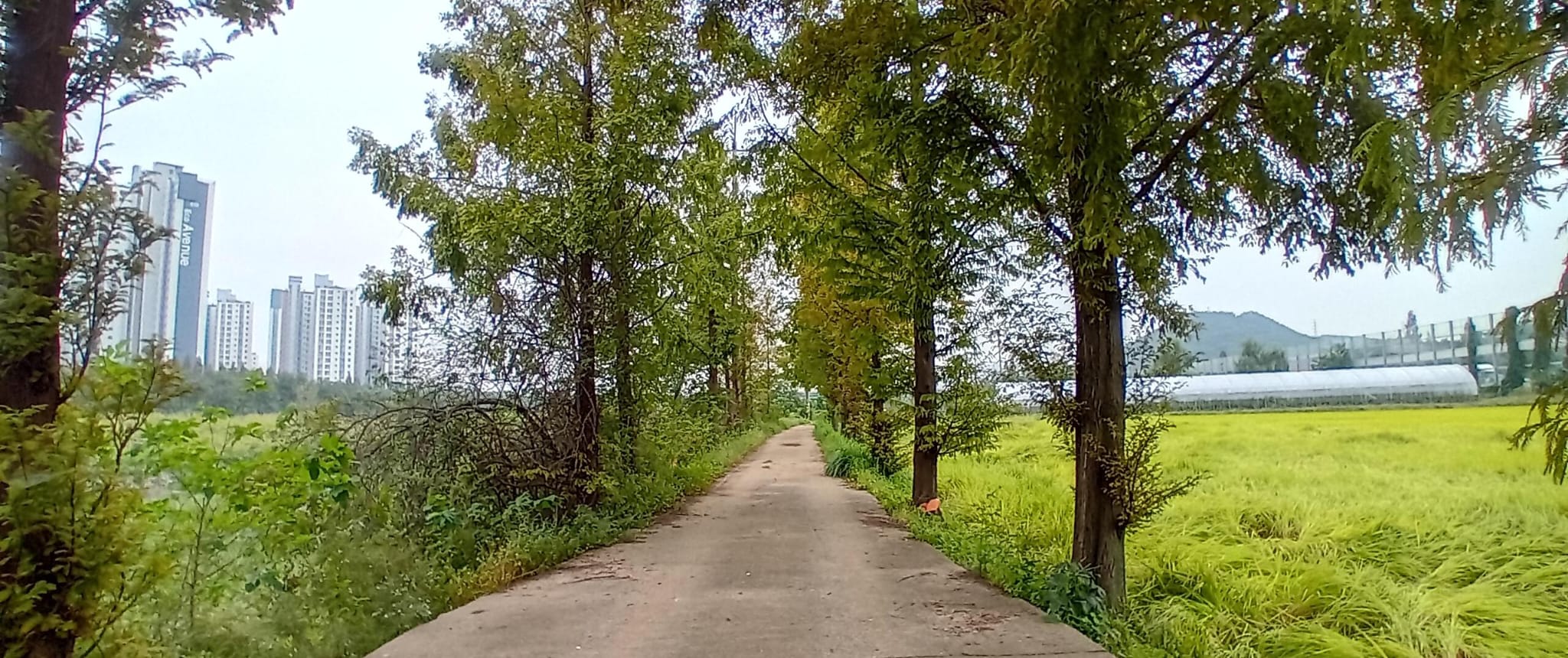
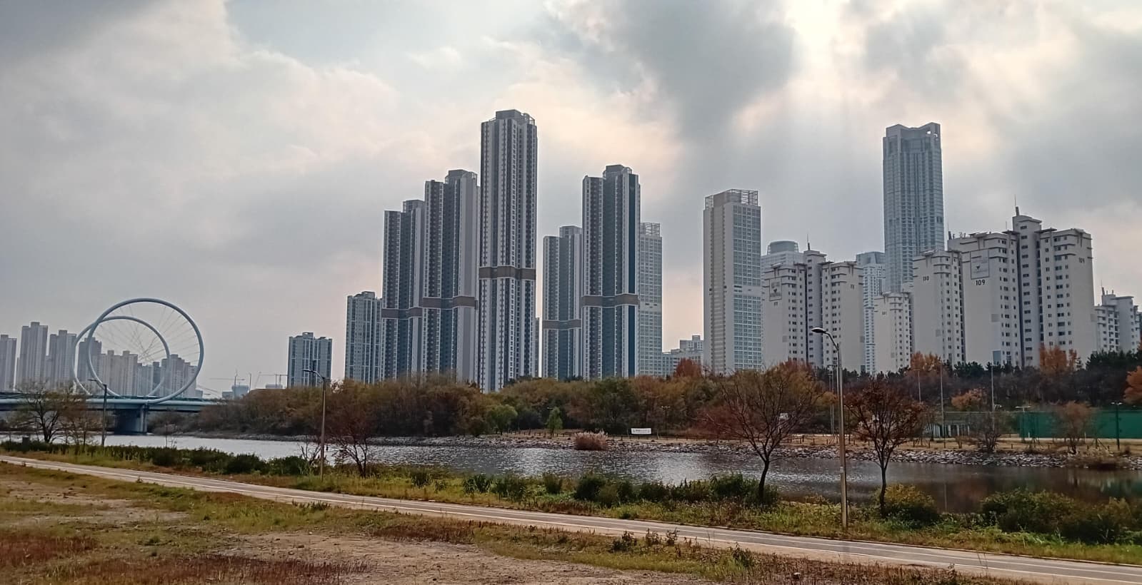
 Roughly the first half of the Jongju-gil, as seen from Soraesan
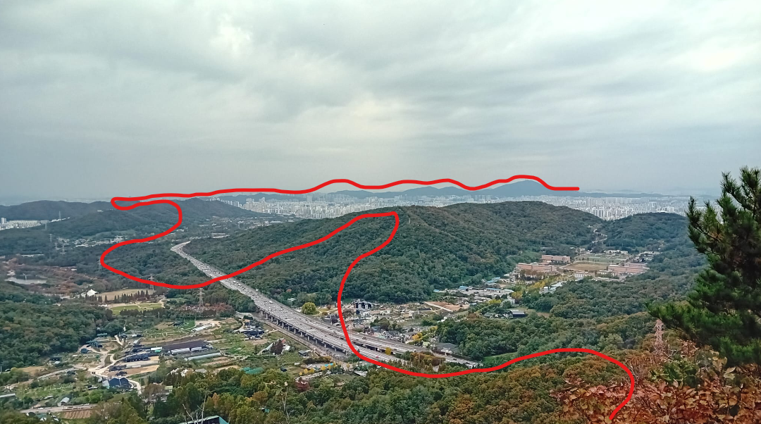
The Jongju-gil is divided into 10 “courses” (sections) of roughly equal length. There are sporadic signposts and ribbons along the way, but I found it helpful to preview each course using the very detailed notes of one Korean blog (which also includes maps, and is my source for the key features and stamp locations).
Course 1: Gyeyangsan (계양산)
- Key Features: Yeonmujeong Pavilion (연무정), Gyeseongjeong Pavilion (계성정), Haneujae Pass (하느재고개), Gyeyangsan Summit (계양산 정상), Helipad (헬기장), Jingmae Pass Ecological Bridge (징매이고개 생태통로)
- Stamp Location: Gyeyangsan Summit (계양산 정상)
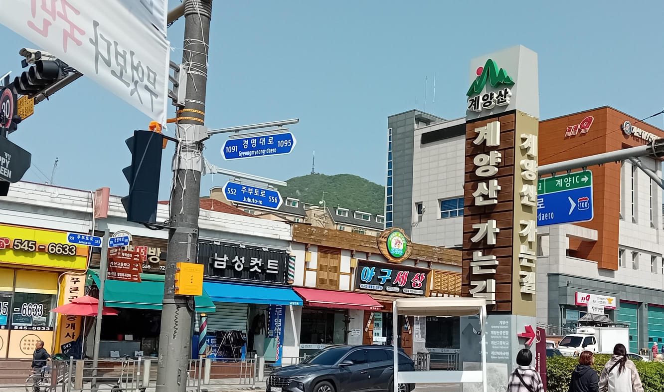
One warm spring day in 2025, I set off to begin the Jongju-gil. Gyeyangsan is a tough start to the trail, as you immediately climb over 700 stairs to the highest peak (395m). I had debated whether to bring a third bottle of water, so I was surprised to see lots of people hiking with no provisions except a thick coat and a smartphone. A pointer for English speakers: san means “mountain” (or hill), e.g. Gyeyangsan could be translated Gyeyang Mountain.
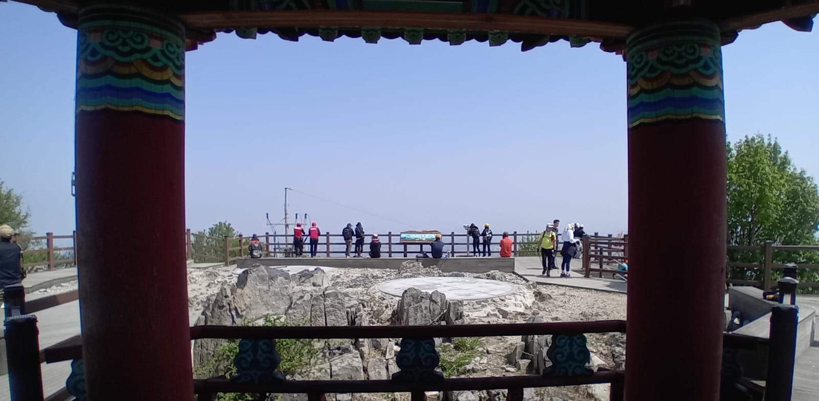
After more huffing and puffing than I’d care to admit, I made it to the peak. A few months later, Gyeyangsan made international news for being covered in ‘lovebugs’. However on my visit, the only ‘wildlife’ to be seen at the summit was a stray cat. The trees have been trimmed to maintain a view in all directions. Despite the haze, I always love to see everyone happy and satisfied as they snap photos with the summit stone.
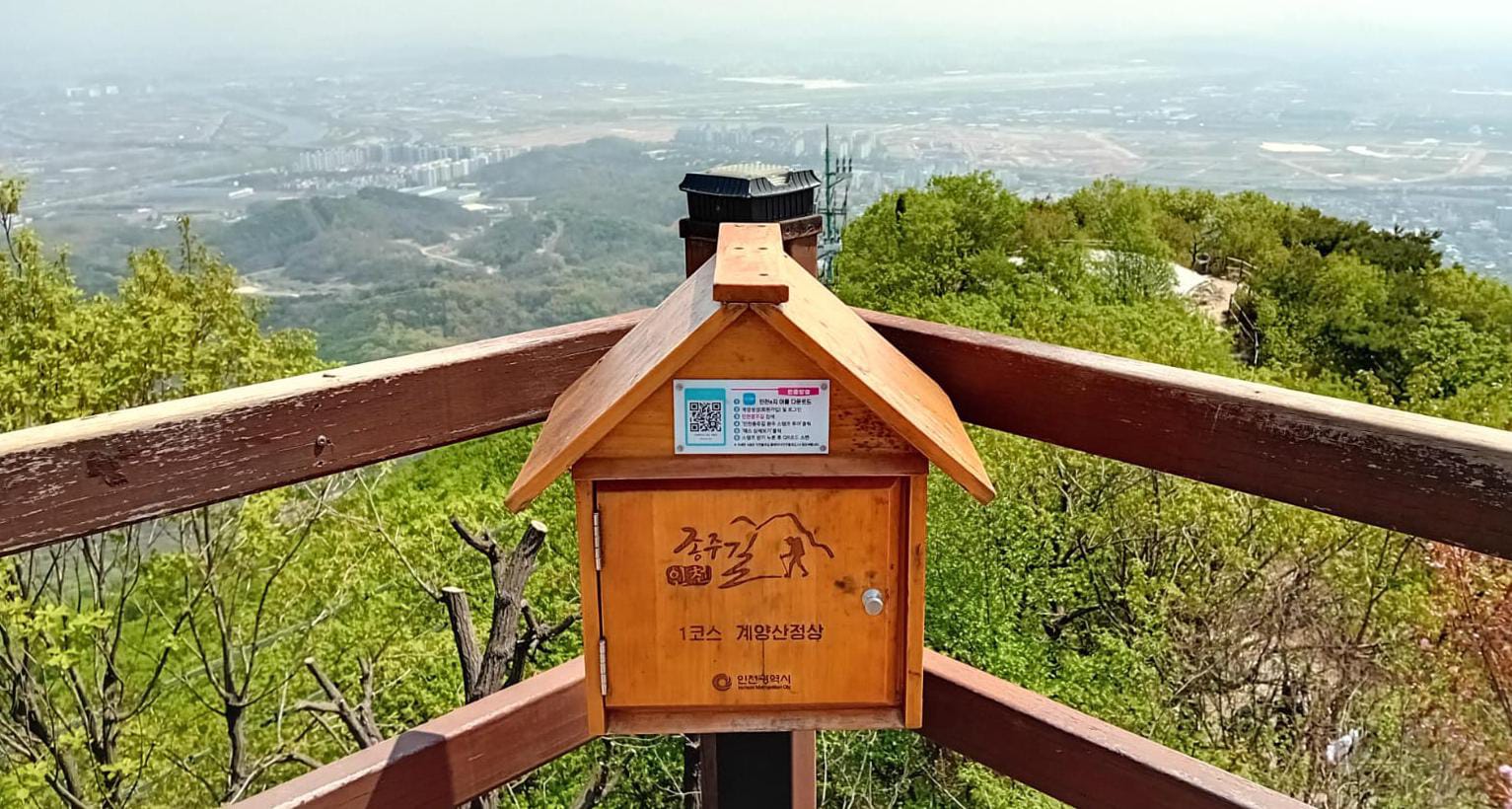
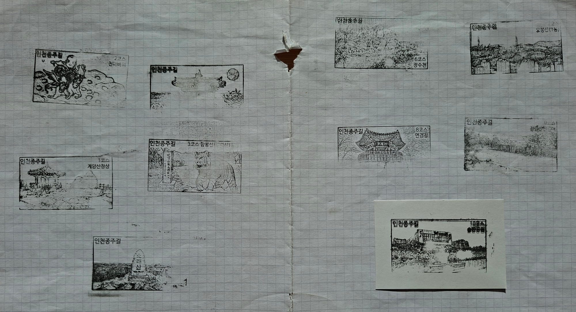
I almost forgot to use the stamp box! There is one for each of the 10 courses. If you document your progress using the app or official stamp booklet, you can get a certificate from Incheon City Hall. I didn’t want to use roaming data for the app, nor figure out how to get the booklet, but I did enjoy collecting stamps on a scrap of paper.
I think these stamp boxes are a really fun idea. I’d love to see them on the hills in England. But I’ve never seen anyone else use them, and one or two were in a bad state of repair, so I’m not sure how popular they are. South Korea is a high tech society so maybe people prefer the app.
The photo above looks southwest, towards the mountains of Course 2. Descending on the western side of Gyeyangsan is totally different to ascending from the southeast. The crowds are gone, and so are the well-built stairs. The rocky path leads all the way down to the bottom, where a tree-covered bridge crosses a highway. My backup plan was to follow the road back to Gyesan station, but to my surprise I had made good time, so I continued straight onto Course 2…
Course 2: Cheonmasan (천마산)
- Key Features: Jingmae Pass Ecological Bridge (징매이고개 생태통로), Junggubong Peak (중구봉), Cheonmasan (천마산), Hexagonal Pavilion (육각정), Cheonma Rock (천마바위), Ruwon Bridge (루원교)
- Stamp Location: Cheonma Rock Information Board (천마바위 안내문)
…and I’m happy I did, because Course 2 is absolutely stunning. It follows the ridge line through a number of peaks, with panoramas down to the city on both sides – sometimes through the trees, and sometimes from a clearing.
The photo above looks back to Gyeyangsan (in the distance) and Cheonmasan (middleground). An older gentleman was impressed to hear I’d come all the way from Gyeyangsan, but like many older Koreans on the mountains he looked in good shape and I suspect could have comfortably done it himself.
Popular hiking photos usually show lakes and rivers. But I also enjoy cityscapes, and seeing how the city spreads around the contours of the land. I found it incredible to be walking along paths a couple of hundred metres in the sky, accompanied by the odd Oriental turtle dove, swallow and swallowtail butterfly, while sounds of chanting sports teams and urban construction drifted up from below.
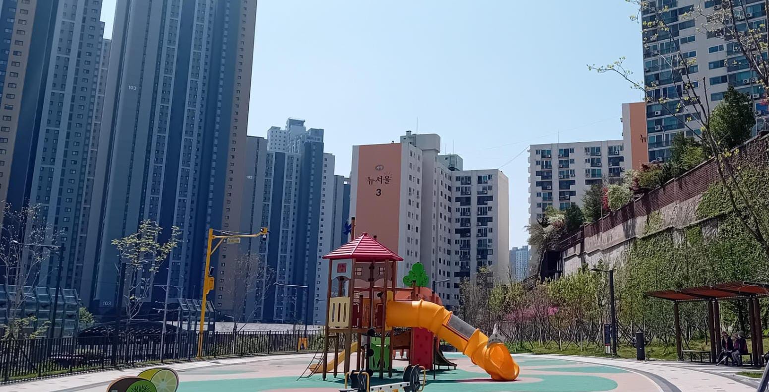
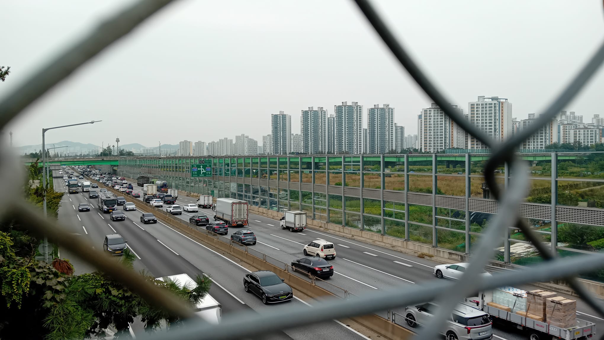
Eventually the trail leads back down to the city, and modernity with its pros and cons. This part of Incheon appears to be newly built. Walking to the subway station was an unhappy contrast with the mountains, walking alongside a big road and hurrying to complete 13-lane crossings before the “blue” (green) man disappeared and the black and white cars started rolling. However the neighbourhoods of tall branded apartment blocks are very pleasant; clean on the inside and outside, with tree-lined gardens.
Course 3: Wonjeoksan (원적산)
- Key Features: Ruwon Bridge (루원교), Wonjeokjeong Pavilion (원적정), Wonjeoksan (원적산), Hambongsan (함봉산), Jang Pass (장고개), Yeoujae Pass (여우재), Baegun Park (백운공원)
- Stamp Location: Hambongsan Summit (함봉산 정상)
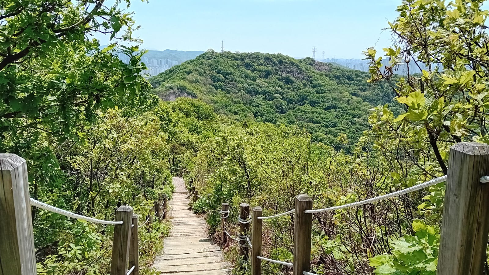
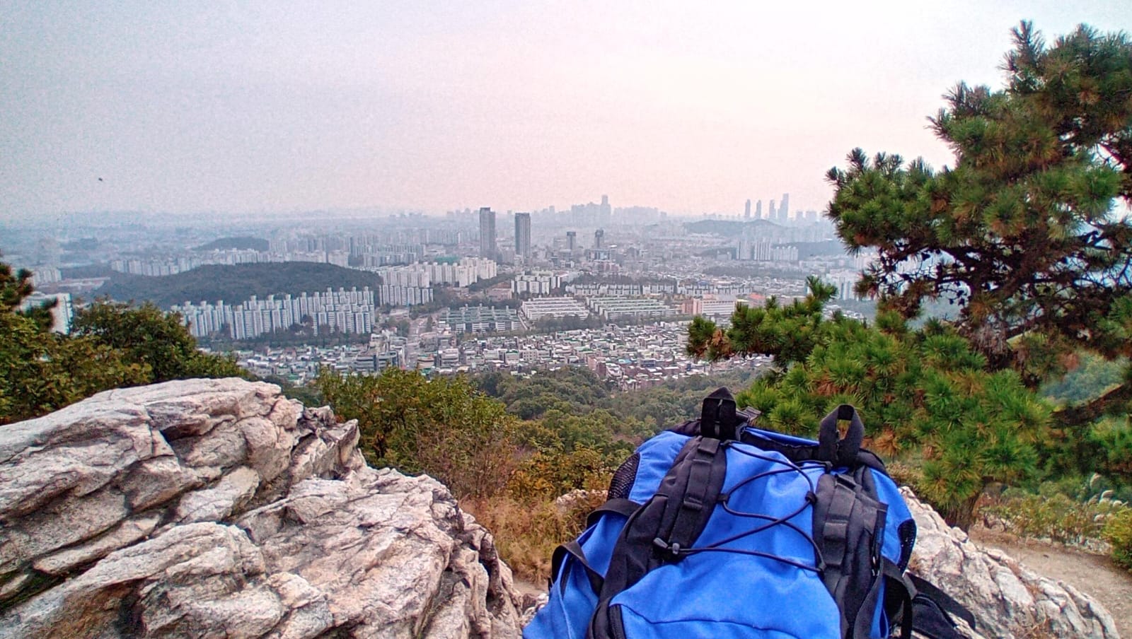
I walked Course 3 on a day that was hotter than I would have liked, but on the plus side there was much less haze, giving extraordinary views over Incheon.
It was easy to follow the early peaks, but later in a forested area I went horribly off track. I was envious of Dulle-gil walkers who seemed to have hundreds of signs, while there were hardly any for the Jongju-gil. Amusingly, one signpost showed two directions for the Dulle-gil but only one for the Jongju-gil, even though it’s a through-route so there should be two for both.
Unfortunately when I finally doubled back and found a wooden post with Jongju-gil arrows painted on it, I was approaching from an unexpected direction, so it misled me into going back north the way I had come. At least I had company in the form of the caterpillars which hung in the air from invisible threads.
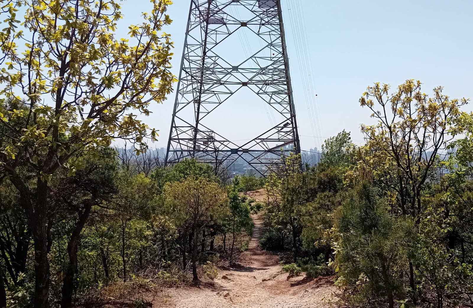
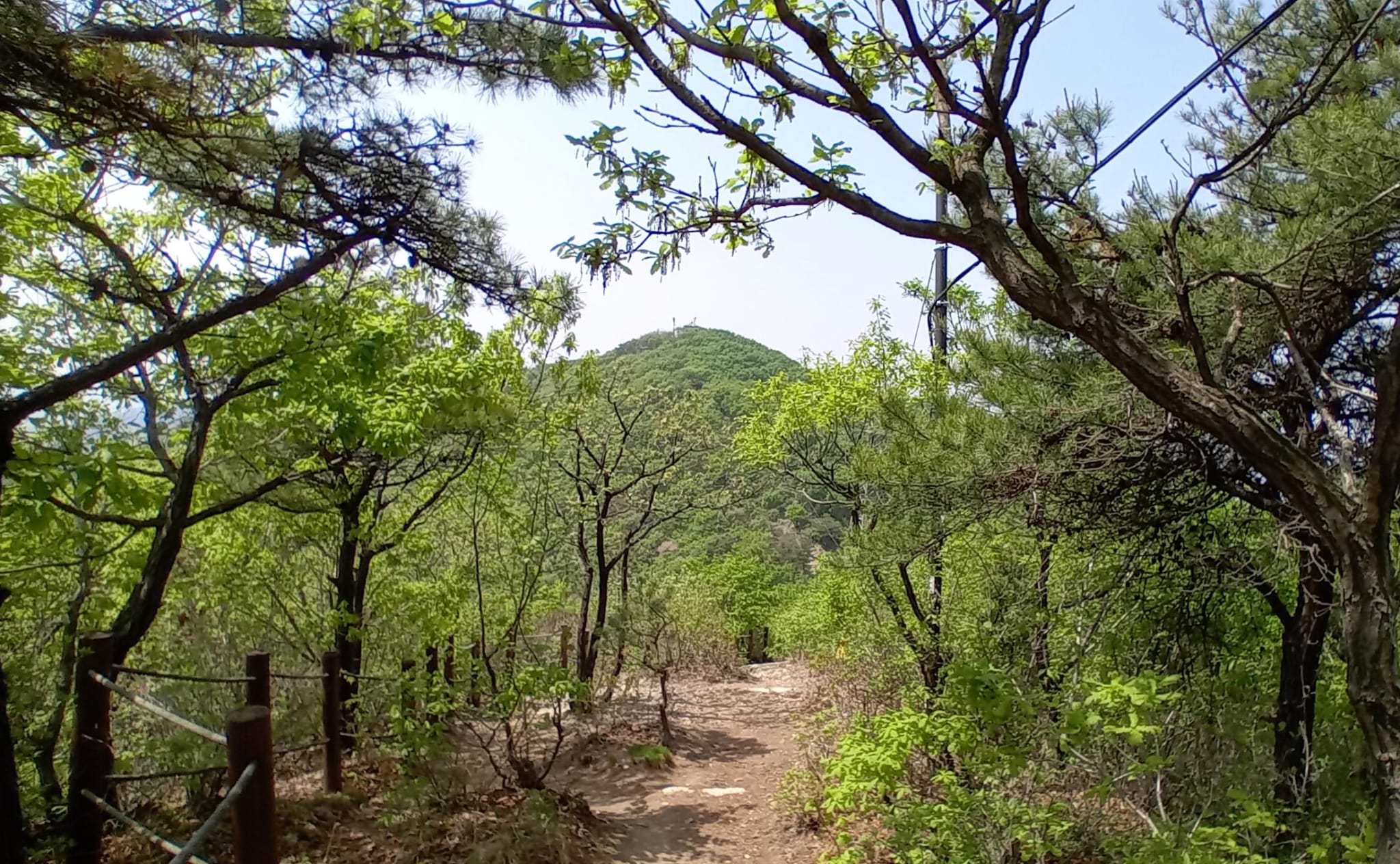
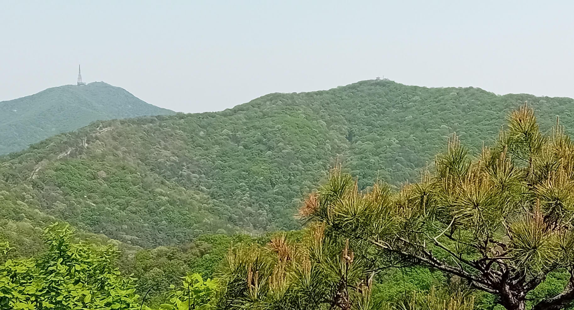
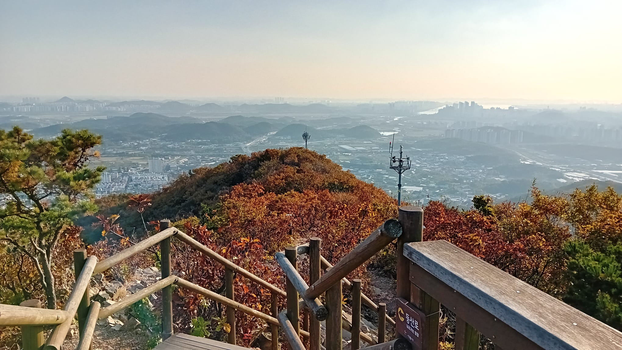
Unlike Courses 1 and 2, there are lots of pylons over the Course 3 mountains. You could choose to see it as spoiling the view, but again I prefer to enjoy the combination of man-made and natural features, and contemplate the engineering effort that went into building pylons up here to bring us fast telecommunications.
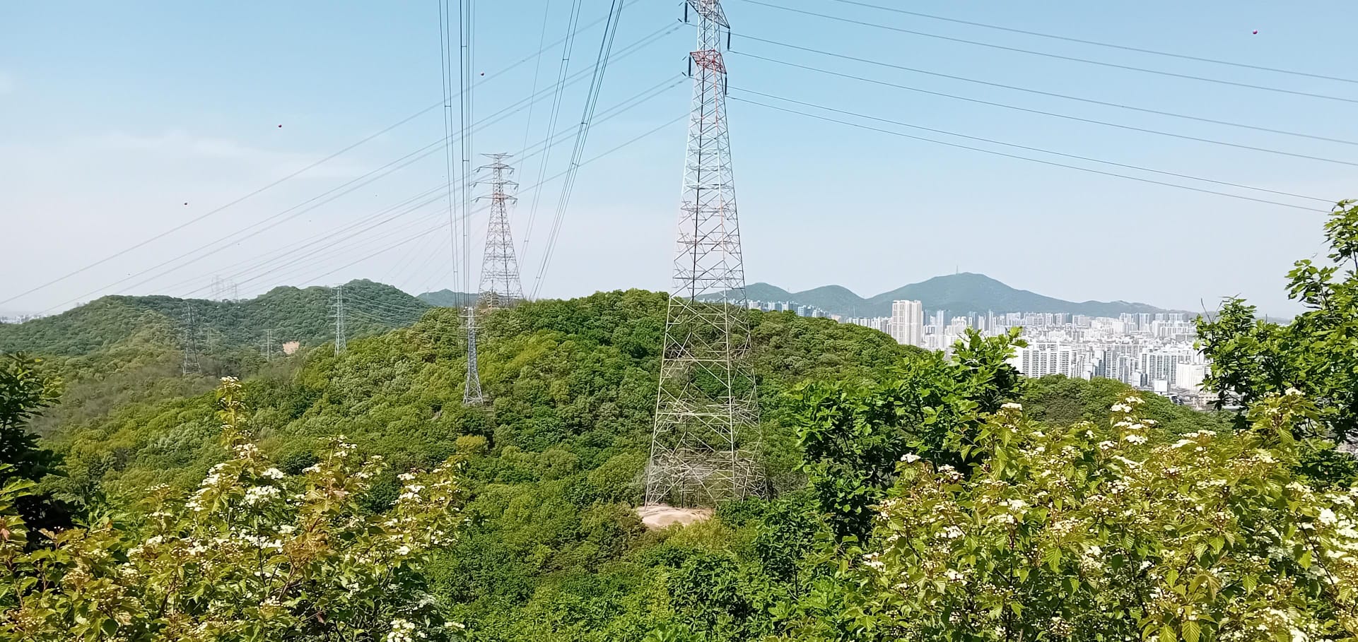
This photo looks back over Course 3, with a bit of Course 2 and then Gyeyangsan from Course 1 in the far distance on the right. One day I need to hike Courses 1 and 2 again in weather this clear.
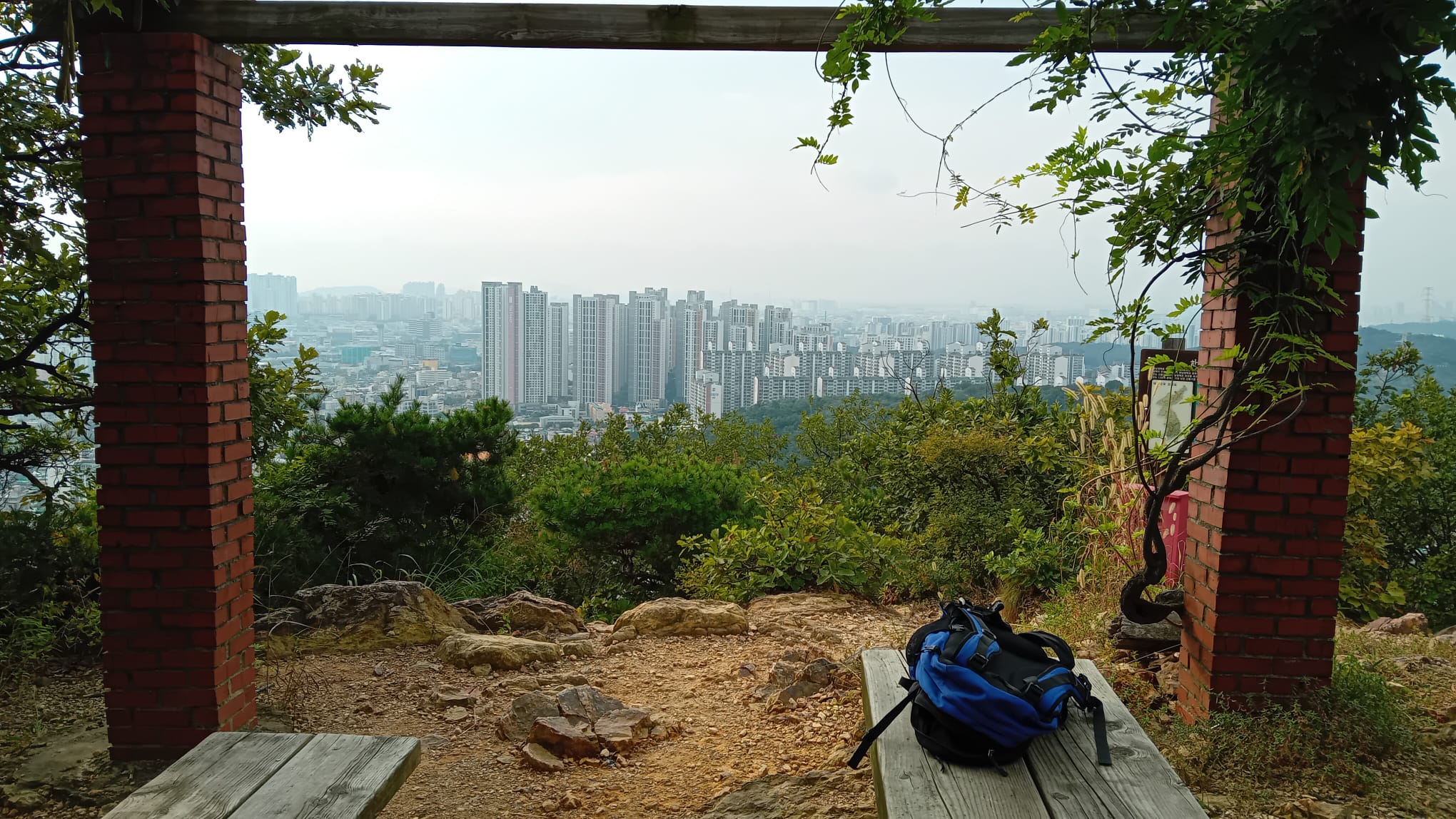
Course 4: Manwolsan (만월산)
- Key Features: Baegunsan Ecological Restoration Forest (백운산 생태복원 숲), Dongamsan (동암산), Manwolsan Summit (만월산 정상), Manwol to Mansusan Connecting Bridge (만월~만수산 연결다리), Salamander Village (도롱뇽마을), Bullo Mineral Spring (불로약수터), Gwanghaksan (광학산)
- Stamp Location: Opposite Manwoljeong Pavilion (만월정 맞은편)
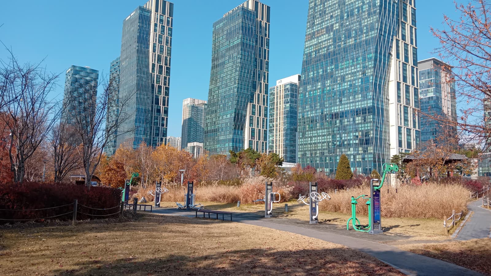
Course 4 starts well with a smallish mountain that has exercise equipment on the top – a healthy and common sight. It then goes back down to the road and up Manwolsan.
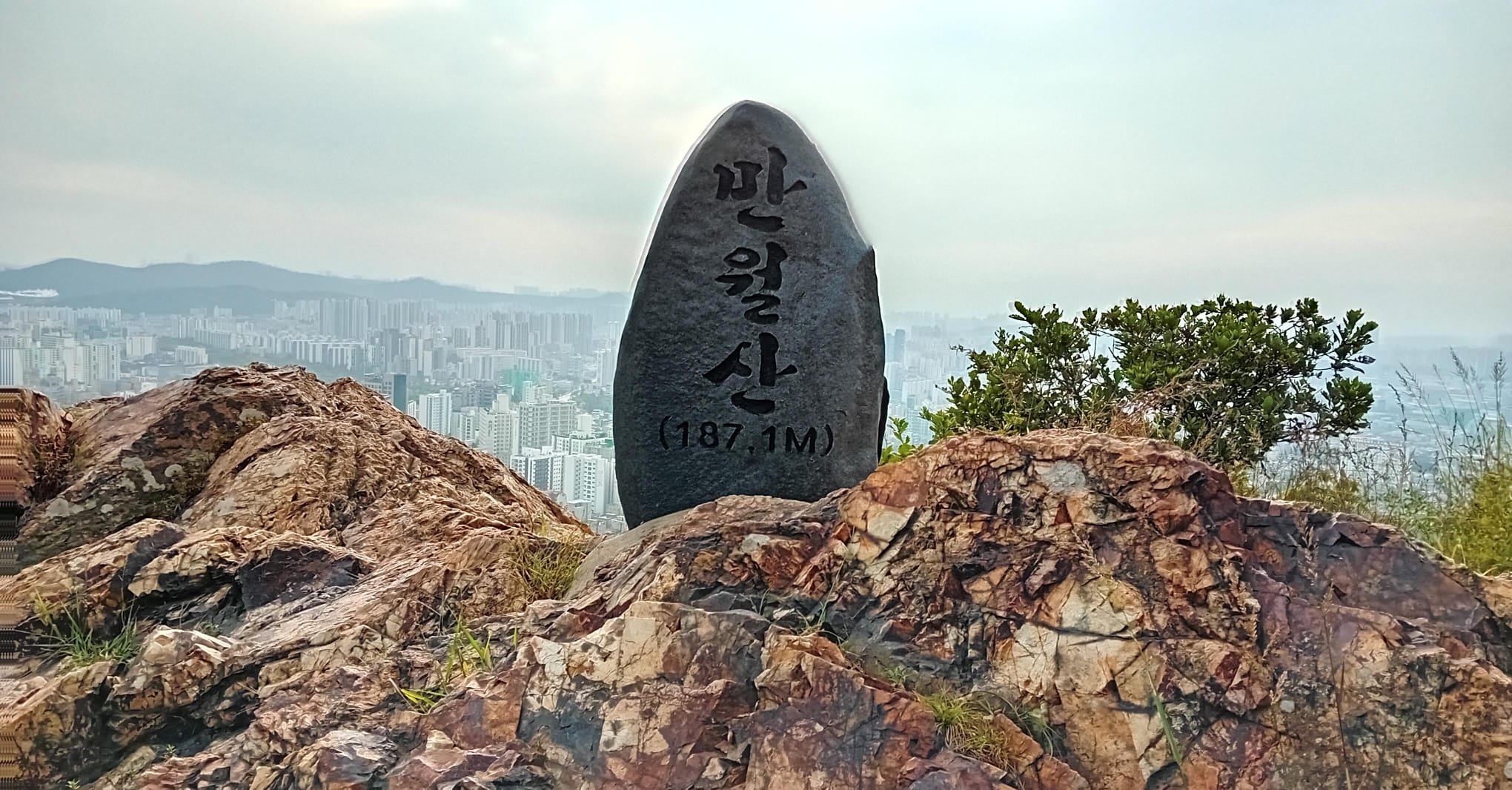
Manwolsan is the highlight of Course 4. I love this kind of rocky summit with hardy pine trees.
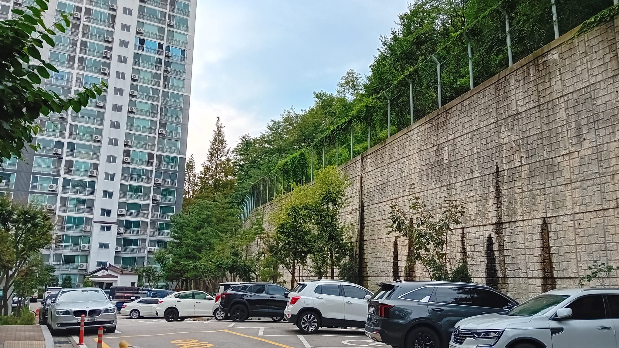
Unfortunately the Jongju-gil then descends back down to a road, and this time workmen at the underpass formed their arms into an X and told me I couldn’t proceed. I was forced to take a roundabout route and try to figure out how to get from this apartment complex back onto the mountain.
I managed to rejoin the Jongju-gil, but regrettably I didn’t enjoy the rest of Course 4. With the sun setting behind me and a swarm of insects like Scottish midges that followed my head, I made a hasty journey along the final few peaks.
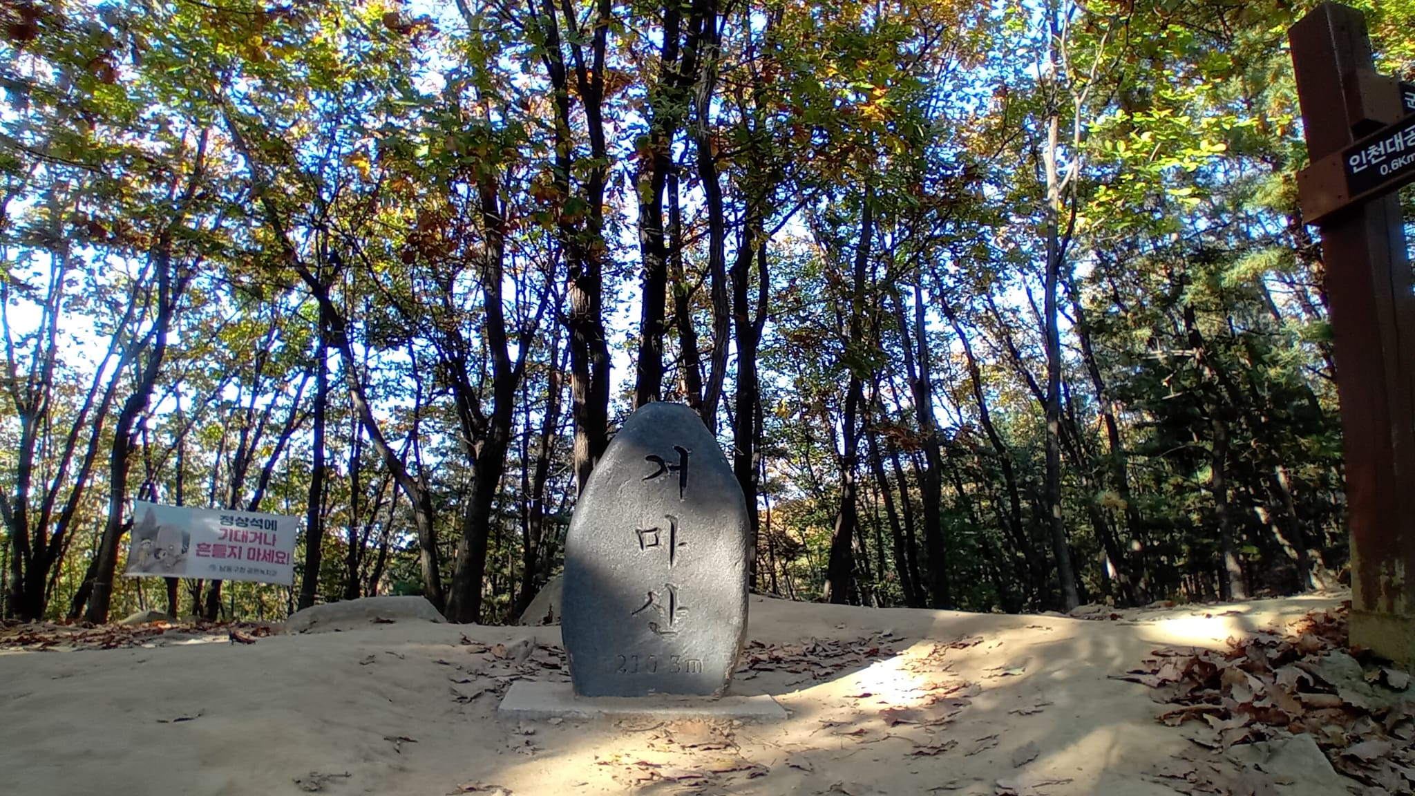
Course 5: Soraesan (소래산)
- Key Features: Bosei Pass (보세이고개), Incheon Grand Park (인천대공원), Geomasan (거마산), Jangsu-dong Ginkgo Tree (장수동 은행나무), Soraesan (소래산), Sangasan (상아산), Gwanmosan (관모산), Baekbeom Square (백범광장), Wetland Garden (습지원)
- Stamp Location: Soraesan Summit (소래산 정상)
Course 5 skirts round the edge of Incheon Grand Park, almost in a loop. On a warm autumn Saturday, the park was full of people relaxing and playing.
Music from a band in Incheon Grand Park floated all the way to the top of Geomasan, giving a dramatic soundtrack to my descent.
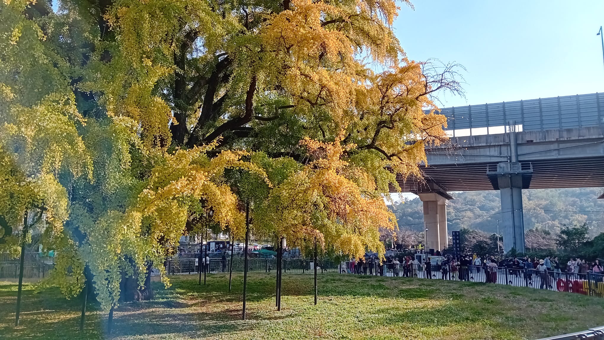
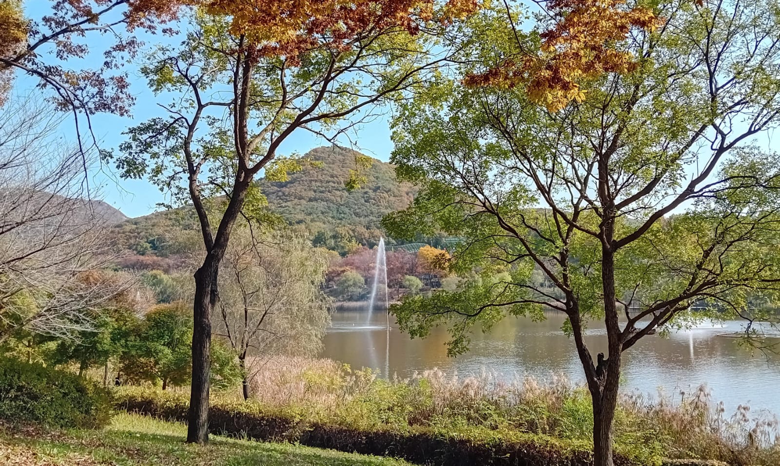
Course 5 is the only stage of the Jongju-gil I have walked in deep autumn colours, part of it with a friend. It was well worth it for both of us. One local mother was so impressed to hear his English, she offered him a job tutoring her kids on the spot. And I was rewarded with a chance to see this majestic 800-year-old ginkgo tree in full yellow leaf.
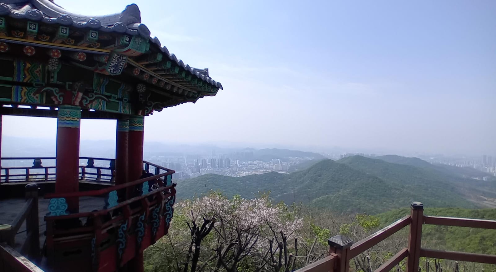
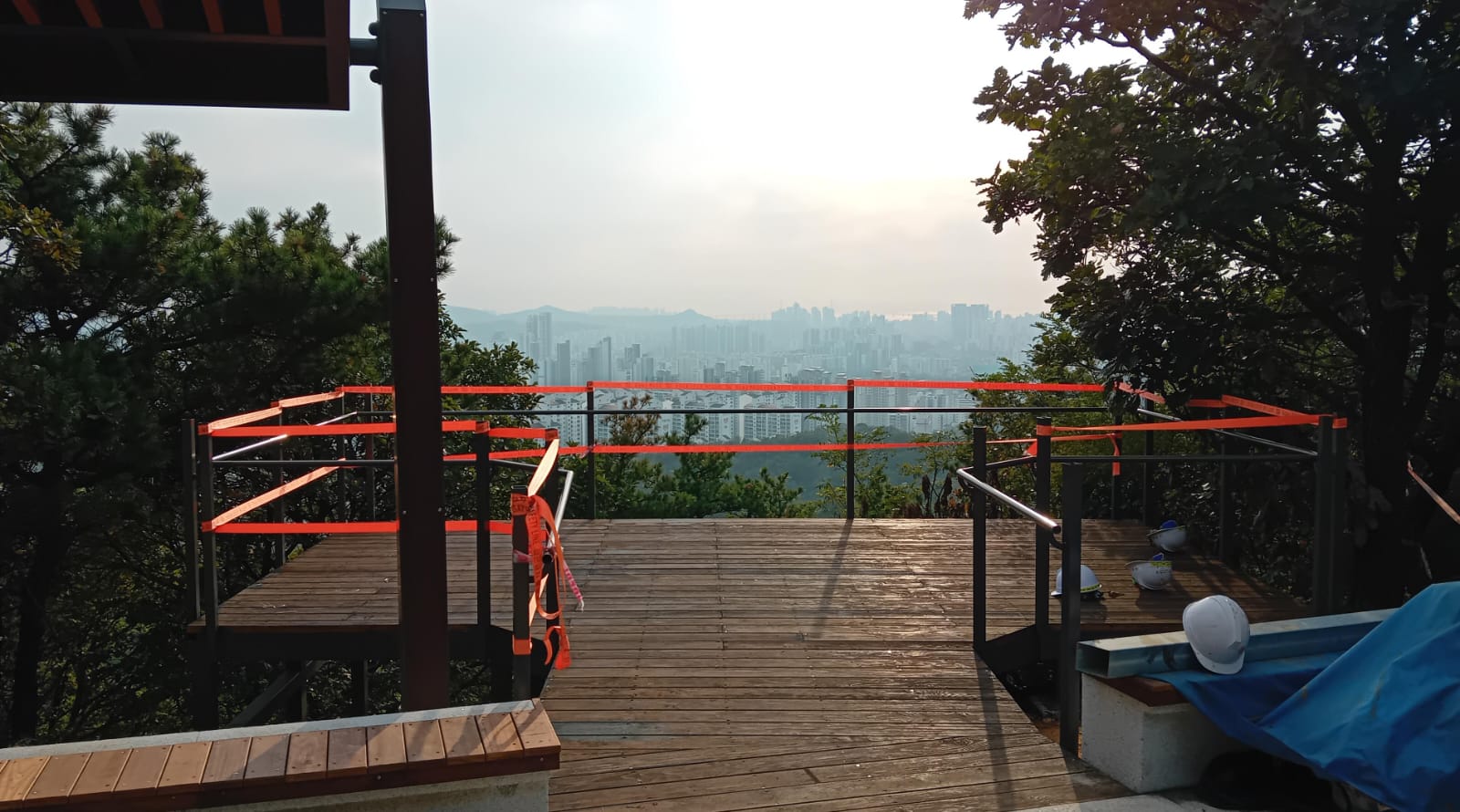
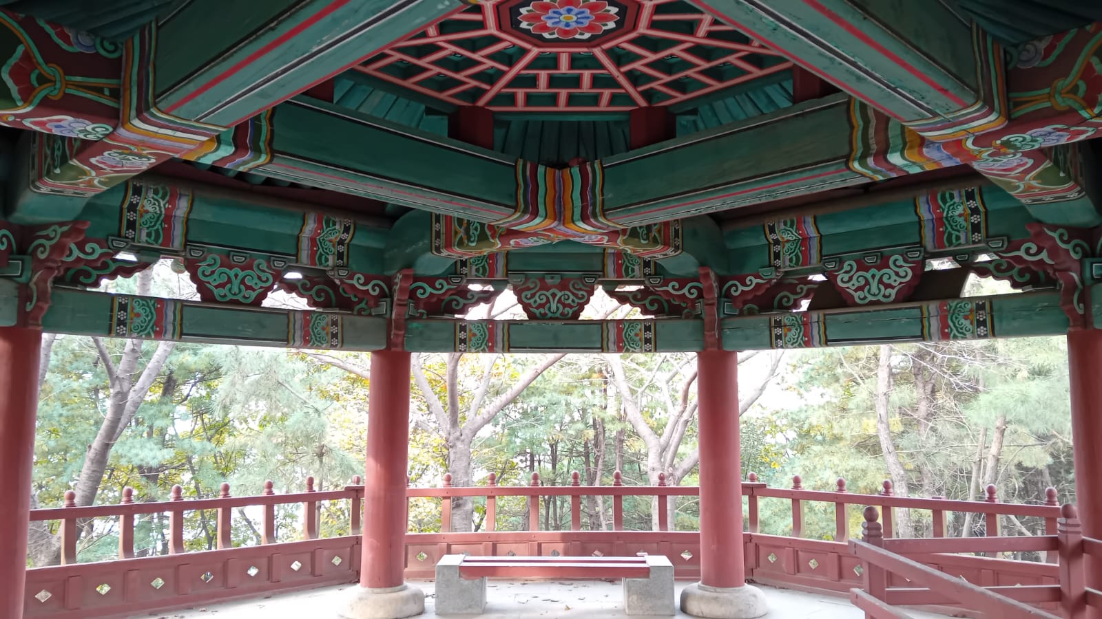
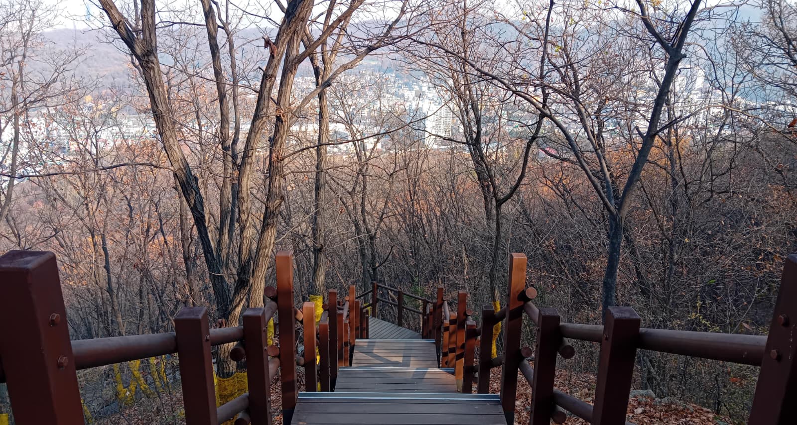
Soraesan, 299.4m, is one of the highlights of the Jongju-gil. Its distinctive head-and-shoulders shape is visible from miles around. My favourite view was to the southwest (pictured), but there are great views in all directions. For some reason the official Jongju-gil path goes through a short rock-climbing section near the peak, but you can take a perfectly safe flight of steps a few metres away to the left. It felt like being on an island in the sky.
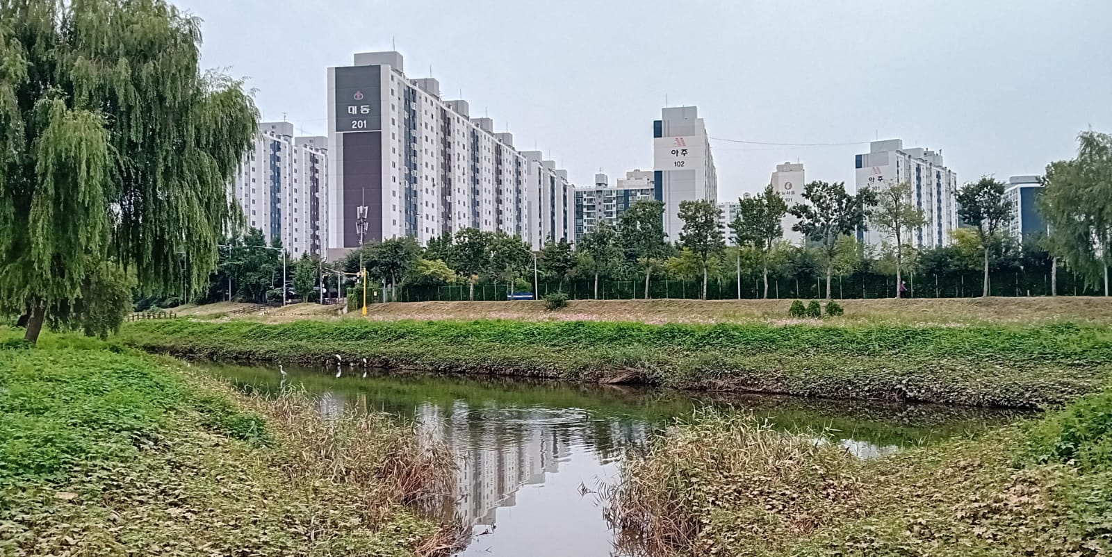
Course 6: Jangsucheon (장수천)
- Key Features: Incheon Grand Park Wetland Garden (인천대공원 습지원), Suhyeon Bridge (수현교), Jangsu Bridge (장수교), Seochang Overpass (서창고가교), Jangsujeon 1st Bridge (장수천1교), Dorim Overpass (도림고가교), Dorim Elementary School (도림초등학교)
- Stamp Location: Jangsucheon Riverside, Shelter in front of Namdong Gymnasium (장수천변, 남동체육관 앞 쉼터)
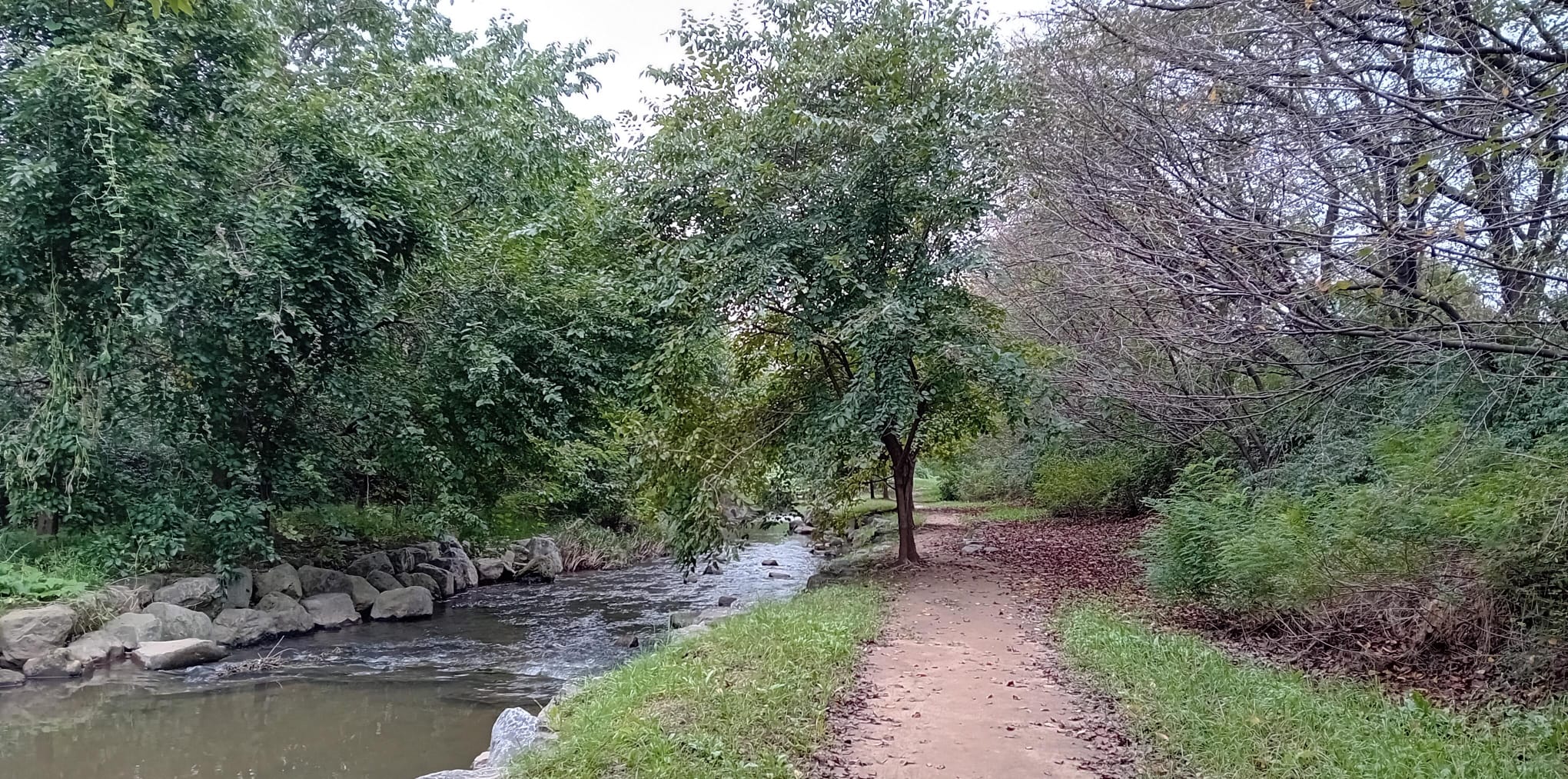
I enjoyed Course 6 much more than I expected. It has no mountains, but instead follows a river south from Incheon Grand Park. I gasped at seeing a kingfisher fly over a pond in the wetlands.
The stream grows into a river, and the reed beds on both sides become wider and wider as it cuts a course through high mud banks (and eventually would lead to the Songdo tidal flats, a key site for the endangered black-faced spoonbill). Large green/yellow/red Joro spiders made webs along the path. Due to the muddy river smells and the busy roads close by, I would not call this journey pleasant. But it is interesting throughout. I saw a few herons and egrets, and some ducks I couldn’t identify without binoculars.
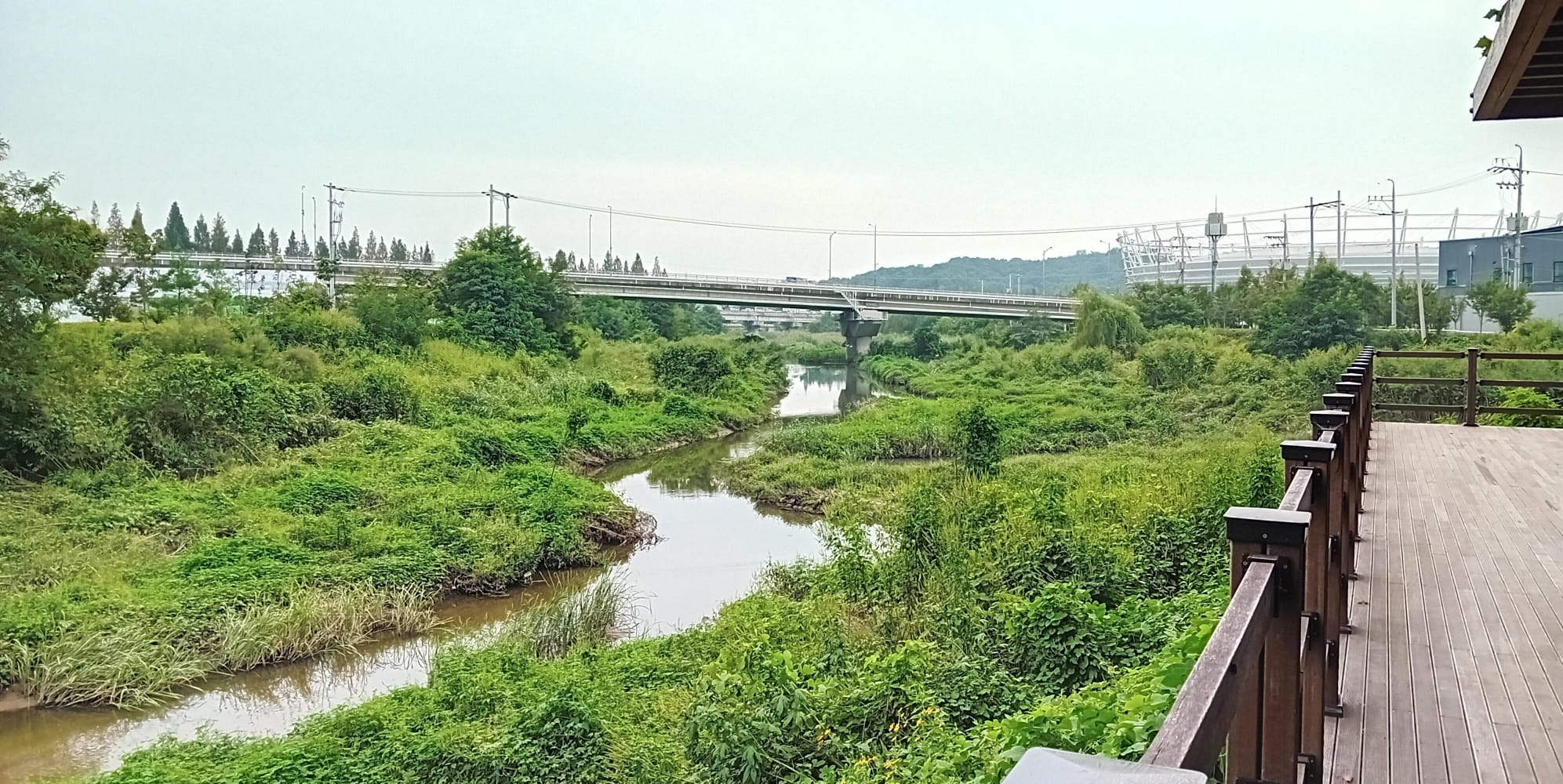
In a fantasy novel there would definitely be a forgotten civilisation living in the mud underneath the highway bridges. But in reality there were only nets and buckets for some kind of fishing.
After one such bridge, I was surprised by this beautiful tree-lined avenue. Sandwiched between the muddy river estuary and a highway, there was a moment to listen to a soundscape of chattering sparrows.
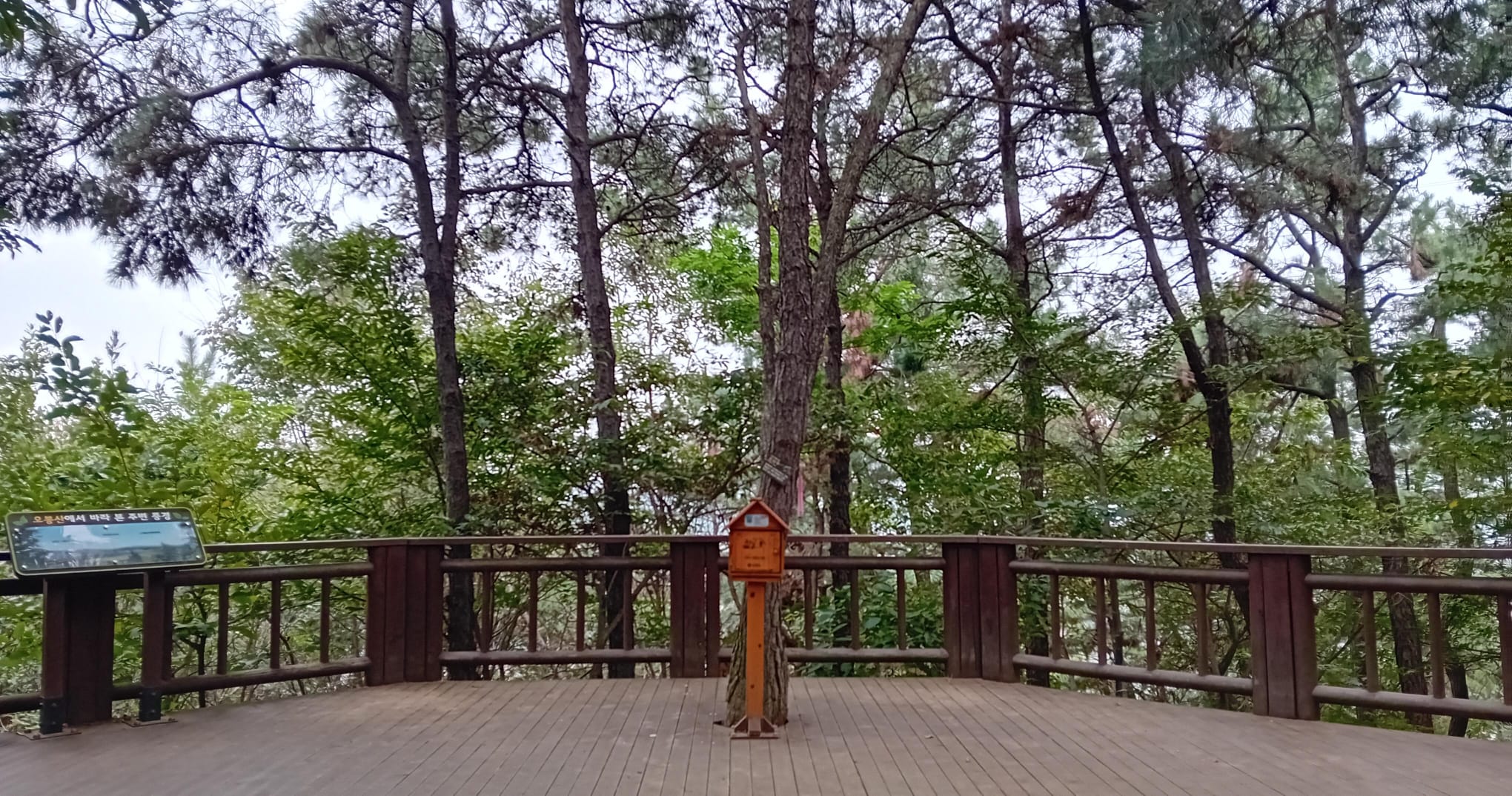
Course 7: Obongsan (오봉산)
- Key Features: Dorim Elementary School (도림초등학교), Obongsan (오봉산), Sonangdaengi Pass (소낭댕이고개), Deumbaesan (듬배산), Sariul Park (사리울공원), Seunggi Park (승기공원), Seunggicheon Stream (승기천), Seonhak Hockey Stadium (선학 하키경기장)
- Stamp Location: Obongsan 1st Peak (오봉산 1봉)
Course 7 begins at the foot of Obongsan, across the road from the river. I don’t like walking alongside wide roads, but crossing them on a bridge is quite enjoyable. This photo is still technically on Course 6.
‘Obongsan’ means five-peak-mountain. Alas all five peaks were forested, so I wasn’t able to get a bird’s eye view of Course 6 I had just completed. One hardy lady was walking barefoot, while others were foraging for mushrooms. Cicadas gave a constant buzzing soundtrack.
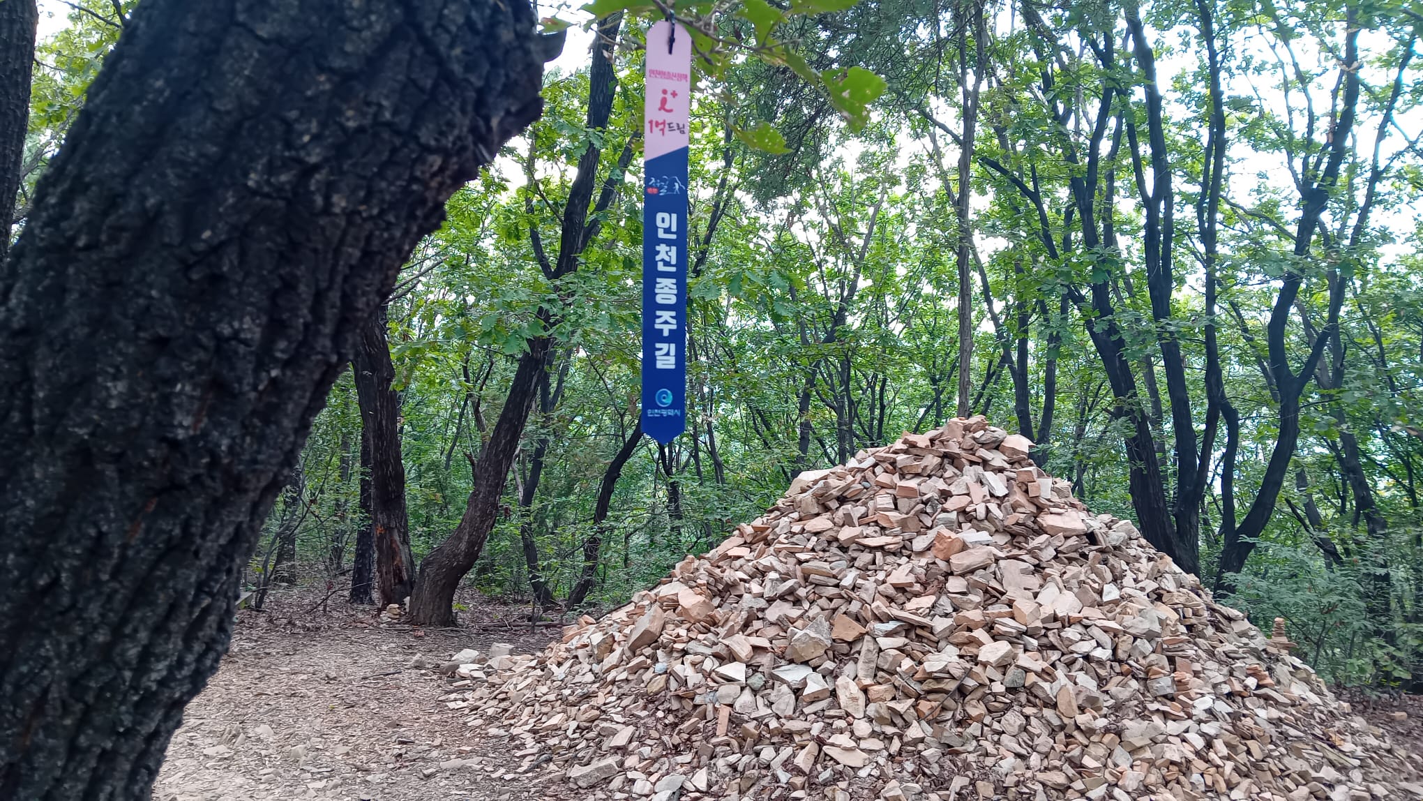
Cairns are quite common on the Korean mountains. This one is a looser style, pictured behind one of the ribbons that mark the Jongju-gil route, on Obongsan peak 4. Cartons of water are another common sight, intended for hikers to fight small fires before they catch hold.
Course 7 then routes through a pleasant park-like apartment complex and an unpleasant set of roads. But once this was over, it opened once more into a fairly nice riverside. I saw more herons and egrets, and a cormorant. Next to a sports centre, many people were enjoying their exercise through walking, jogging and cycling.
Course 8: Munhaksan (문학산)
- Key Features: Seonhak Hockey Stadium (선학 하키경기장), Munhaksan (문학산), Nojeokbong (노적봉), Songdo Station (송도역)
- Stamp Location: Pavilion beyond Munhaksan Summit
Course 8 follows a small mountain range from east to west. I ascended past a flock of brown-eared bulbuls, up a wooden staircase, to this lone pine tree and urban view.
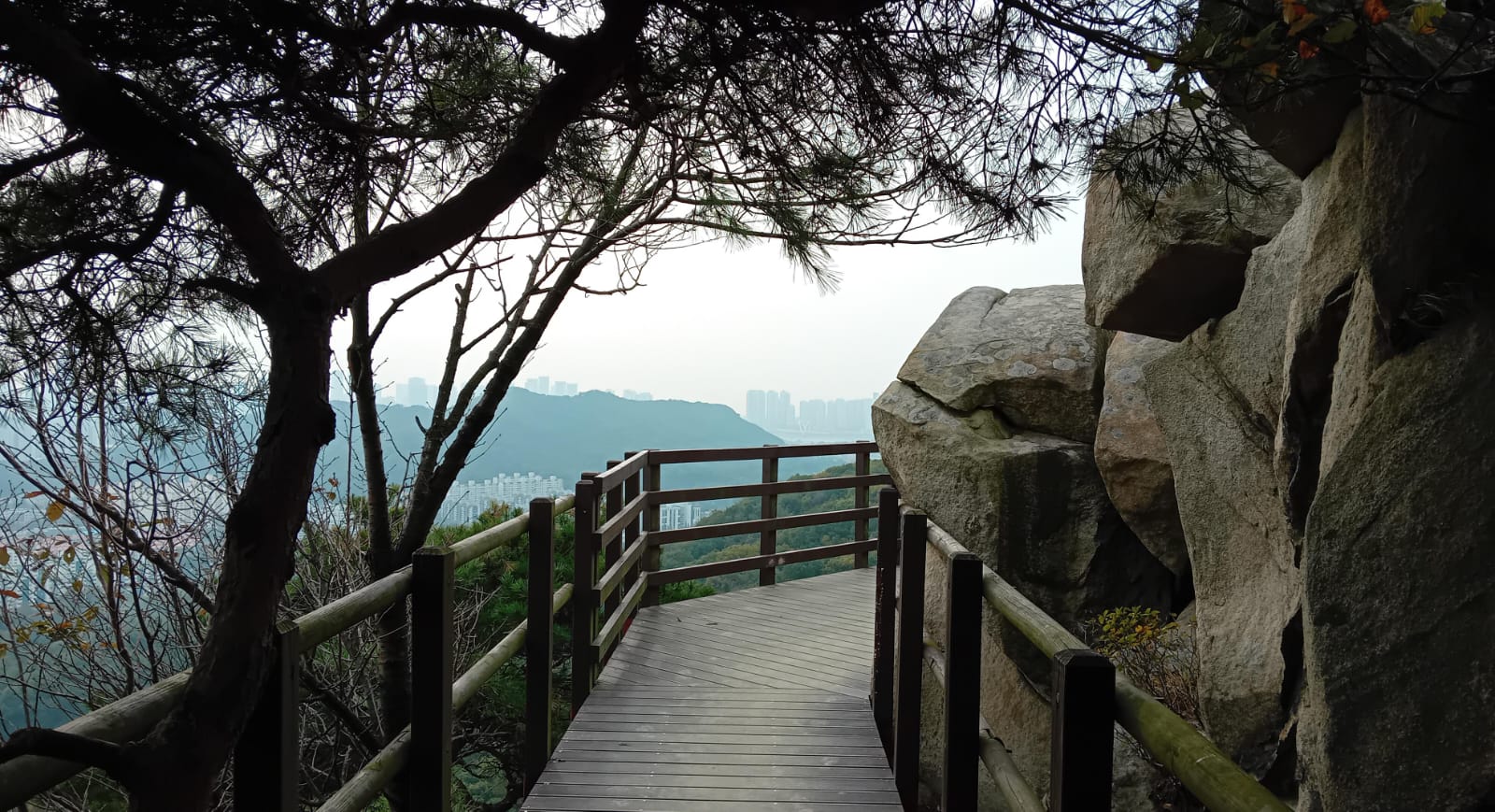
After the initial climb, the route is relatively easy. You follow the ridge, with the mountain slopes dropping off steeply to left and right.
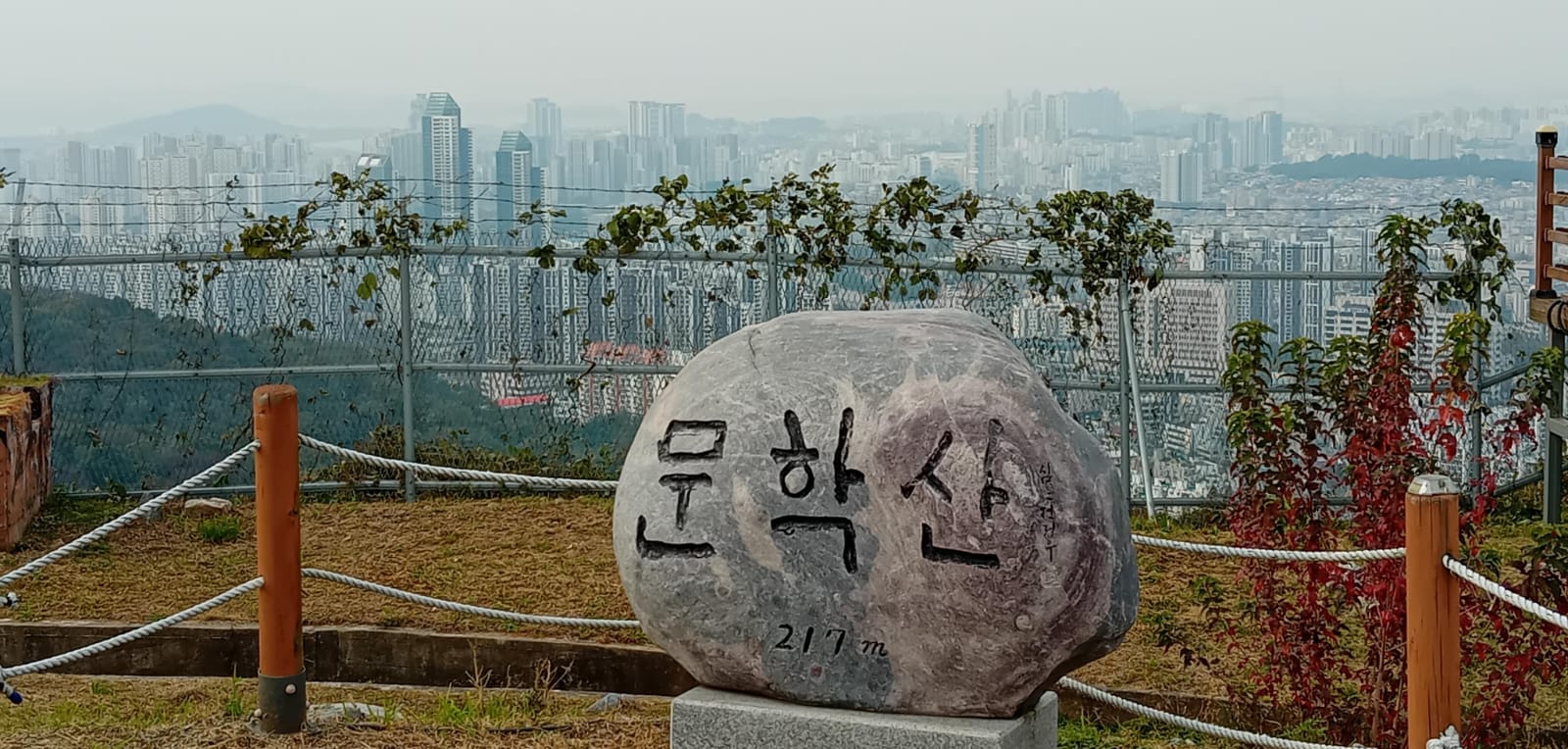
The main feature of Course 8 is Munhaksan. Occasionally on the mountains you find old bunkers from the Korean War and boys on military duty doing exercises. Munhaksan appears to still have use for the army, and apparently it opened to the public only a few years ago.
The stamp box is towards the end of the course, at a pavilion. Always check which stamp box you are using, because not all of them are for the Jongju-gil – it would be easy to get a stamp for the Dulle-gil by mistake!
Course 9: Cheongryangsan (청량산)
- Key Features: Songdo Station (송도역), Cheongryangsan (청량산), Bongjaesan (봉재산), Songdo MTB Park (송도MTB파크)
- Stamp Location: Bongjaesan Summit (봉재산 정상)
By the time I made it out to Course 9, the best of the autumn leaves had fallen. But I also enjoy the bleakness of winter. You can see more views through the trees, and somehow, like the robin in England, the varied tit seems particularly beautiful on bare winter branches.
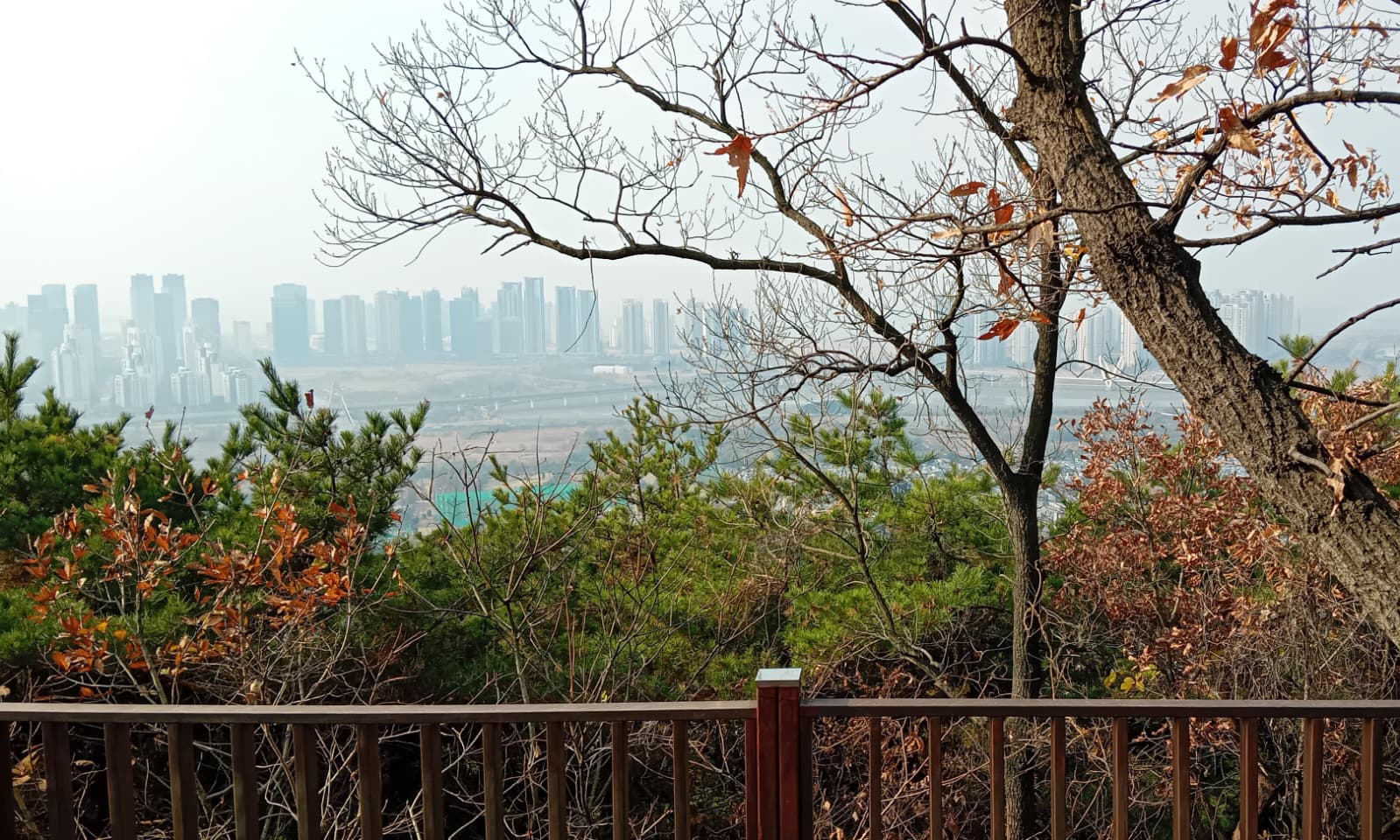
This is the last mountain section of the Jongju-gil. It has good views down to the modern Songdo International City, which will be explored in Course 10.
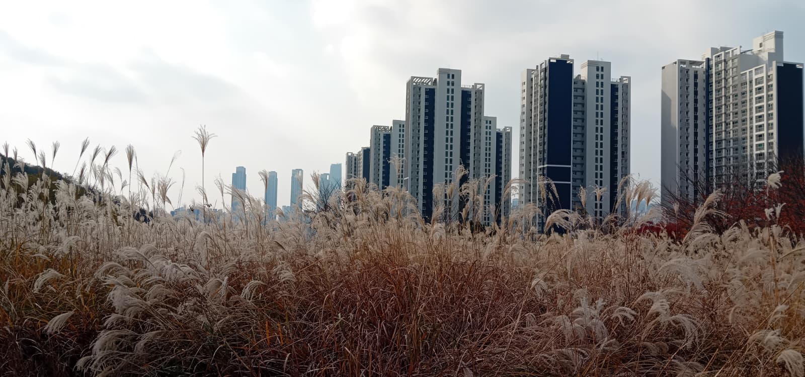
Course 9 routes through some interesting parks. I was amazed by this field of long grass; I have not seen anything else like it in Korea. I sat in a swinging chair and listened to the chatter of Oriental magpies and the clang of apartment construction at the same time.
This mountain biking park is overlooked by the 60 storey apartment blocks of “campus city”. There were no bikes when I visited, but the tyre marks suggested it is well used. One man canoed down the canal.
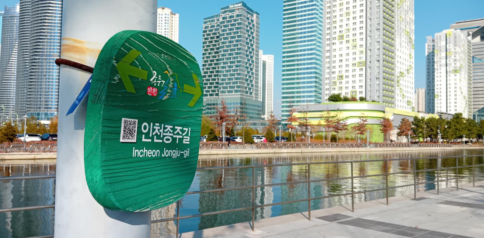
Course 10: Songdo International City (송도국제도시)
- Key Features: Songdo International Bridge (송도국제교), Saeachim Park X-Games Arena (새아침공원 X-게임장), Central Park (센트럴파크), Tri-Bowl (트라이볼), Incheon Bridge Observatory (인천대교 전망대), Art Center (아트센터), Solchan Park (솔찬공원)
- Stamp Location: Final Point of Incheon Jongjugil (인천종주길 마지막 지점)
Course 10 connects the green areas of Songdo International City. The Songdo area consists of 1500 acres of land reclaimed from the sea (or mud flats) in the 1990s, so this final section of the Jongju-gil is completely flat. Like Course 6, it is not a section for mountaineers, but again quite interesting from an urban-exploration perspective.
After leaving this popular city-centre waterfront, the route continues a long, long way, out to the harbour. This sounds nicer than it is, because the path is straight and exposed, and mostly next to a road. It’s also almost deserted. I wouldn’t attempt it in the heat, the rain, the wind, or with a child.
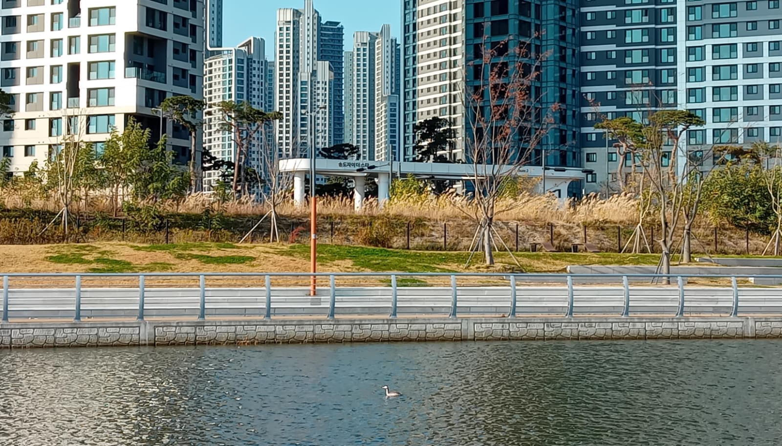
But I made the best of it. This is a black-necked grebe (I think), dwarfed by apartment blocks. Everything is super-scaled in Songdo; if you’re not driving then it’s a lengthy walk between skyscrapers. Even more than other Korean cities, the roads here are wide and fast, although not very busy: at one point I crossed a nine-lane road where not a single car was waiting.
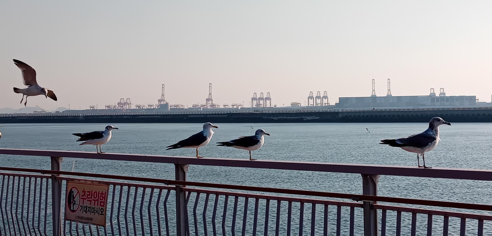
The final stretch is along a harbour wall. To the right there are views of the impressive 21km Incheon Bridge, which connects the mainland to the airport. I navigated past lots of men and women fishing, and eventually made it to a popular boardwalk area, with people playing and cycling and disobeying signs by feeding the seagulls. I found the last stamp box, stamped a piece of card, and with that I had finished the Jongju-gil!
Overall, I found the Jongju-gil to be an engaging hiking route, and one that is easy to break into half-day trips. Visitors looking for more of a challenge should prioritise Courses 1, 2, 3 and 5. Those who prefer flatter, more urban walks will find Courses 6 and 10 are the best. But if time allows, the full Jongju-gil is well worth completing from start to end.